Victoria is the capital city of the province of British Columbia, Canada. It is located on the southern tip of Vancouver Island and is known for its natural beauty, historic architecture, and vibrant cultural scene. Victoria stands on the southeastern coast of Vancouver Island, overlooking the Juan de Fuca Strait. It is approximately 100 kilometers southwest of Vancouver, the largest city in British Columbia. Today Victoria is home to more than 290 thousand residents. This map shows the detailed scheme of Victoria streets, including major sites and natural objecsts.
Zoom in or out, move the map's center by dragging your mouse or click the plus/minus buttons to zoom. Also check out a street view and a satellite map of Victoria.
The exact coordinates of Victoria, Canada for your GPS track:
Latitude 48.429333 North, Longitude 123.364555 West.
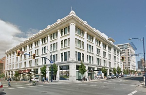
An image of Victoria, Canada:
Check out some more city maps in Canada:
Full list of Canada maps
This online map of Victoria (Canada) is provided by Bing Maps.
Please add a bookmark and share the page with your friends!