The exact coordinates of Sierra Vista Southeast Arizona for your GPS track:
Latitude 31.470966 North, Longitude 110.257072 West.
Please share the link with friends and neighbors:
Share on Facebook
Share on WhatsApp
Share on Telegram
Share on Facebook
Share on WhatsApp
Share on Telegram
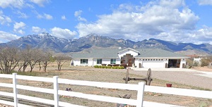
An image of Sierra Vista Southeast
More city maps of Arizona:
- Map of Surprise
Surprise, Arizona is a fast growing city in the northwestern part of Phoenix metro area. Its popul... - Map of San Tan Valley
San Tan Valley is an unincorporated community (CDP) in the southeastern part of Phoenix metro area... - Map of Bullhead City
Bullhead City, Arizona is a city standing upon Colorado River in Mohave County, about 100 miles so... - Map of Sahuarita
Sahuarita, Arizona is a pleasant town found in Pima County. The population of Sahuarita exceeds 35... - Map of Anthem
Anthem, Arizona is a charming community found in Maricopa County, about 32 miles north of downtown... - Map of Douglas
Douglas, Arizona is a charming city in Cochise County, standing on the United States-Mexico border... - Map of Valencia West
Valencia West, Arizona is a CDP located in Pima County. It stands 10 miles southwest of Tucson. Th... - Map of Tucson Estates
Tucson Estates, Arizona is a CDP located in Pima County, about 13 miles southwest of Tucson. Tucso... - Map of Gold Canyon
Gold Canyon is a CDP located in Pinal County, Arizona. It is situated at the foot of the Superstit... - Map of Sedona
Sedona, Arizona is a beautiful town located in Coconino County. It's a popular resort, known for t... - Map of Winslow
Winslow is a city situated in Navajo County, Arizona. It is known for its connection to the song "... - Map of Globe
Globe, Arizona is a charming city located in Gila County. It stands in the Tonto Basin region of A... - Map of Village of Oak Creek
The Village of Oak Creek, often referred to simply as "The Village," is a small, unincorporated co... - Map of Benson
Benson, Arizona is a city in Cochise County. It stands 45 miles southeast of Tucson, in the San Pe... - Map of Doney Park
Doney Park, Arizona is a rural community located in Coconino County. It stands in the high-altitud...
This online map of Sierra Vista Southeast, Arizona is provided by Bing Maps. Please add a bookmark and share the page with your friends!