The exact coordinates of Colorado Springs Colorado for your GPS track:
Latitude 38.833233 North, Longitude 104.82325 West.
ZIP codes for Colorado Springs:
80901 80902 80903 80904 80905 80906 80907 80908 80909 80910 80911 80912 80913 80914 80915 80916 80917 80918 80919 80920 80921 80922 80923 80924 80925 80926 80927 80928 80929 80930 80931 80932 80933 80934 80935 80936 80937 80938 80939 80941 80942 80944 80946 80947 80949 80950 80951 80960 80962 80970 80977 80995 80997
Please share the link with friends and neighbors:
Share on Facebook
Share on WhatsApp
Share on Telegram
Share on Facebook
Share on WhatsApp
Share on Telegram
Check out some popular locations in Colorado Springs:
- McDonald's in Colorado Springs
- Starbucks in Colorado Springs
- Walmart in Colorado Springs
- Wells Fargo in Colorado Springs
- Chase Bank in Colorado Springs
- CVS in Colorado Springs
- 7-Eleven in Colorado Springs
- Gyms in Colorado Springs
- Car wash in Colorado Springs
- Landmarks in Colorado Springs
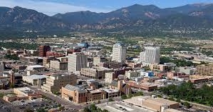
An image of Colorado Springs
More city maps of Colorado:
- Map of Denver
Denver is the capital city of Colorado state. It's sometimes called Mile-High City because its ele... - Map of Centennial
Centennial, Colorado (incorporated 2001) is a young and fast growing city located on the southern ... - Map of Loveland
Loveland, Colorado is a part of Fort Collins-Loveland conurbation. The population of Loveland is o... - Map of Castle Rock
Castle Rock, Colorado is a town, incorporated in 1881, that is located 20 miles south to downtown ... - Map of Littleton
Littleton, Colorado is a southern suburb of Denver with 45 thousand residents. It is a home rule m... - Map of Security-Widefield
Security-Widefield, Colorado is a nice suburban CDP of Colorado Springs, located in El Paso County... - Map of Pueblo West
Pueblo West, Colorado is a CDP situated about 42 miles south of Colorado Springs, in Pueblo County... - Map of Louisville
Louisville, Colorado is a charming city found 22 miles north of Denver, in Boulder County. The pop... - Map of Cañon City
Cañon City, Colorado is a charming city located in Fremont County. It stands in the central part ... - Map of Greenwood Village
Greenwood Village, Colorado is a suburban city located in Arapahoe County. It is a part of the Den... - Map of Lone Tree
Lone Tree, Colorado is an adorable suburban city located in Douglas County. It is part of the Denv... - Map of Cherry Creek
Cherry Creek is a CDP located near Denver, in Arapahoe County, Colorado. The population of Cherry ... - Map of Rifle
Rifle, Colorado is a city located in Garfield County. It is situated in the western part of the st... - Map of Fairmount
Fairmount, Colorado is an unincorporated community located in Jefferson County. It is situated clo... - Map of The Pinery
The Pinery is a residential community located in Douglas County, Colorado. It is a suburban area s... - Map of Evergreen
Evergreen, Colorado is an adorable picturesque mountain town located in Jefferson County. It is ne... - Map of Craig
Craig is a lovely city situated in Moffat County, in northwestern Colorado, approximately 40 miles...
This online map of Colorado Springs, Colorado is provided by Bing Maps. Please add a bookmark and share the page with your friends!