Miami-Dade County on the map of Florida 2026. Cities, roads, borders and directions in Miami-Dade County of Florida.
USA / Florida / Miami-Dade CountyMiami-Dade is the most populous county in the state of Florida. It is home to more than 2.7 million people. The county seat of Miami-Dade is the famous city of Miami. The total area of the county is approximately 1946 square miles. This map shows the borders of Miami-Dade County as well as neighboring counties, including major highways and natural objecsts as of 2026. Zoom in or out of the map using the plus/minus panel. Move the center of this map by dragging it. Also check out the satellite map of Miami-Dade County.
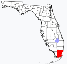
The borders of Miami-Dade County over the map of Florida
Explore some more counties of Florida:
- Washington County
- Walton County
- Wakulla County
- Volusia County
- Union County
- Taylor County
- Suwannee County
- Sumter County
- Seminole County
- Sarasota County
- Santa Rosa County
- St. Lucie County
- St. Johns County
- Putnam County
- Polk County
- Pasco County
- Osceola County
- Okeechobee County
- Okaloosa County
- Nassau County
Full list of Florida maps
This online map of Miami-Dade County, Florida is provided by Bing Maps. Please add a bookmark and share the page with your friends!
© 2026 City maps and famous places