The exact coordinates of Hazard Kentucky for your GPS track:
Latitude 37.250317 North, Longitude 83.193634 West.
ZIP codes for Hazard:
41701 41702
Please share the link with friends and neighbors:
Share on Facebook
Share on WhatsApp
Share on Telegram
Share on Facebook
Share on WhatsApp
Share on Telegram
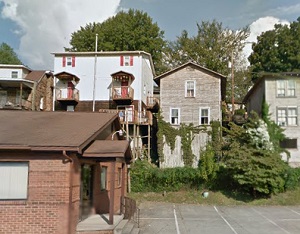
An image of Hazard
More city maps of Kentucky:
- Map of Florence
Florence, Kentucky is an excellent city located in Boone County, about 13 miles southwest to Cinci... - Map of Jeffersontown
Jeffersontown, Kentucky is a prominent suburban city situated in Jefferson County, about 14 miles ... - Map of Ashland
Ashland, Kentucky is an excellent city located in Boyd County, on the southern bank of Ohio River.... - Map of Burlington
Burlington, Kentucky is a CDP serving as the county seat of Boone County. The total population of ... - Map of Danville
Danville is a charming city in Boyle County of central Kentucky. The population of Danville exceed... - Map of Shepherdsville
Shepherdsville, Kentucky is a city in Bullitt County. It stands about 20 miles south of Louisville... - Map of Campbellsville
Campbellsville, Kentucky is a charming city located in Taylor County. It stands 85 miles south of ... - Map of Francisville
Francisville, Kentucky is a dynamic CDP situated in Boone County, on the southern bank of Ohio Riv... - Map of Middletown
Middletown, Kentucky is a wonderful city situated in Jefferson County. It's part of the Louisville... - Map of Hillview
Hillview is a city in Bullitt County in the central part of Kentucky. It sits 15 miles south of do... - Map of Corbin
Corbin is the county seat of Laurel County, southeastern Kentucky. It stands along Interstate 75, ... - Map of Pikeville
Pikeville is the county seat of Pike County. It's located in eastern Kentucky, in the Appalachian ... - Map of Morehead
Morehead, Kentucky is the county seat of Rowan County. It is home to the famous Morehead State Uni... - Map of Highland Heights
Highland Heights, Kentucky is a pleasant city in Campbell County. It is situated near the northern... - Map of Fort Wright
Fort Wright, Kentucky is a charming city in Kenton County. It's a part of the greater Cincinnati m... - Map of Walton
Walton, Kentucky is a city in Boone County. It's a part of the Cincinnati/Northern Kentucky metro ...
This online map of Hazard, Kentucky is provided by Bing Maps. Please add a bookmark and share the page with your friends!