The exact coordinates of Middletown Kentucky for your GPS track:
Latitude 38.245747 North, Longitude 85.53791 West.
Please share the link with friends and neighbors:
Share on Facebook
Share on WhatsApp
Share on Telegram
Share on Facebook
Share on WhatsApp
Share on Telegram
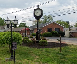
An image of Middletown
More city maps of Kentucky:
- Map of Florence
Florence, Kentucky is an excellent city located in Boone County, about 13 miles southwest to Cinci... - Map of Jeffersontown
Jeffersontown, Kentucky is a prominent suburban city situated in Jefferson County, about 14 miles ... - Map of Ashland
Ashland, Kentucky is an excellent city located in Boyd County, on the southern bank of Ohio River.... - Map of Burlington
Burlington, Kentucky is a CDP serving as the county seat of Boone County. The total population of ... - Map of Danville
Danville is a charming city in Boyle County of central Kentucky. The population of Danville exceed... - Map of Shepherdsville
Shepherdsville, Kentucky is a city in Bullitt County. It stands about 20 miles south of Louisville... - Map of Campbellsville
Campbellsville, Kentucky is a charming city located in Taylor County. It stands 85 miles south of ... - Map of Francisville
Francisville, Kentucky is a dynamic CDP situated in Boone County, on the southern bank of Ohio Riv... - Map of Hillview
Hillview is a city in Bullitt County in the central part of Kentucky. It sits 15 miles south of do... - Map of Corbin
Corbin is the county seat of Laurel County, southeastern Kentucky. It stands along Interstate 75, ... - Map of Pikeville
Pikeville is the county seat of Pike County. It's located in eastern Kentucky, in the Appalachian ... - Map of Morehead
Morehead, Kentucky is the county seat of Rowan County. It is home to the famous Morehead State Uni... - Map of Highland Heights
Highland Heights, Kentucky is a pleasant city in Campbell County. It is situated near the northern... - Map of Fort Wright
Fort Wright, Kentucky is a charming city in Kenton County. It's a part of the greater Cincinnati m... - Map of Walton
Walton, Kentucky is a city in Boone County. It's a part of the Cincinnati/Northern Kentucky metro ... - Map of Hazard
Hazard, Kentucky is the county seat of Perry County. It's located in the eastern part of the state...
This online map of Middletown, Kentucky is provided by Bing Maps. Please add a bookmark and share the page with your friends!