The exact coordinates of Old Jefferson Louisiana for your GPS track:
Latitude 30.383041 North, Longitude 91.016495 West.
Share on Facebook
Share on WhatsApp
Share on Telegram
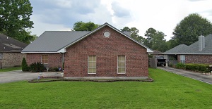
An image of Old Jefferson

More city maps of Louisiana:
- Map of Lake Charles
Lake Charles is one of the biggest cities in Louisiana with population of about 72 thousand people... - Map of Metairie
Metairie, Louisiana is a CDP on the northwestern edge of New Orleans metro area. With 142 thousand... - Map of Marrero
Marrero, Louisiana is a stylish suburban CDP of New Orleans, found in Jefferson Parish. The popula... - Map of Terrytown
Terrytown, Louisiana is a charming CDP located near New Orleans, in Jefferson Parish. The populati... - Map of Sulphur
Sulphur, Louisiana is a dynamic city located in Calcasieu Parish. Sulphur is home to 21 thousand r... - Map of Estelle
Estelle is an unincorporated community located in Jefferson Parish, Louisiana. It stands just west... - Map of Luling
Luling is a small town in St. Charles Parish, Louisiana. It's located on the west bank of the Mis... - Map of Minden
Minden is a lovely city located in the northwestern part of Louisiana. It's the parish seat of Web... - Map of Moss Bluff
Moss Bluff, Louisiana is a CDP located in Calcasieu Parish. It stands near the city of Lake Charle... - Map of Covington
Covington is a city situated in St. Tammany Parish in southeastern Louisiana. It stands on the nor... - Map of Jefferson
Jefferson, Louisiana is a suburban CDP located in Jefferson parish. It stands on the northern bank... - Map of Denham Springs
Denham Springs is a city in Livingston Parish of southeastern Louisiana, located northeast of Bato... - Map of Eden Isle
Eden Isle is a community located on the northern shore of Lake Pontchartrain, near Slidell in St. ... - Map of St. Rose
St. Rose, Louisiana is a CDP located in St. Charles Parish. It sits on the east bank of the Missis... - Map of Addis
Addis, Louisiana is a dynamic town located in West Baton Rouge Parish. It is part of the Baton Rou... - Map of Elmwood
Elmwood, Louisiana is a CDP located in Jefferson Parish. It stands in the greater New Orleans metr... - Map of Walker
Walker is a city located in Livingston Parish, Louisiana. It's a part of the larger Baton Rouge me...
This online map of Old Jefferson, Louisiana is provided by Bing Maps. Please add a bookmark and share the page with your friends!
