The exact coordinates of Scituate Massachusetts for your GPS track:
Latitude 42.195675 North, Longitude 70.724998 West.
ZIP codes for Scituate:
02066
Share on Facebook
Share on WhatsApp
Share on Telegram
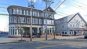
An image of Scituate

More city maps of Massachusetts:
- Map of Cambridge
Cambridge, Massachusetts is a large suburb of Boston and home for MIT and Harvard University. The ... - Map of Quincy
Quincy, Massachusetts (incorporated 1888) is a southern suburb of Boston with 94 thousand resident... - Map of Lawrence
Lawrence, Massachusetts is a city in Merrimack Valley with 80 thousand residents. This industrial ... - Map of Plymouth
Plymouth, Massachusetts is a coastal town known as "America's Hometown" due to its historical role... - Map of Weymouth
Weymouth, Massachusetts is a lovely city located in Norfolk County. It stands 12 miles south of Bo... - Map of Salem
Salem, Massachusetts is a coastal city found in Essex County, about 21 miles northeast of Boston. ... - Map of Billerica
Billerica, Massachusetts is a lovely town located in Middlesex County, about 24 miles northwest of... - Map of Chelsea
Chelsea, Massachusetts is a suburban city of Boston situated in Suffolk County. Today Chelsea is p... - Map of Holyoke
Holyoke, Massachusetts is a nice city located near Springfield in Hampden County. Incorporated in ... - Map of Randolph
Randolph, Massachusetts is a historic city found 17 miles south of Boston, in Norfolk County. The ... - Map of Dracut
Dracut, Massachusetts is a stylish historic town standing 32 miles northwest of Boston, in Middles... - Map of North Andover
North Andover, Massachusetts is an adorable town located 28 miles north of Boston, in Essex County... - Map of Northampton
Northampton, Massachusetts is a wonderful city and the county seat of Hampshire County. Founded in... - Map of Agawam
Agawam, Massachusetts (founded in 1636) is a stylish city located near Springfield, in Hampden Cou... - Map of Walpole
Walpole, Massachusetts is an adorable town located in Norfolk County. Incorporated back in 1724, W... - Map of Dedham
Dedham, Massachusetts is a charming town and the county seat of Norfolk County. The population of ... - Map of Hingham
Hingham, Massachusetts is an attractive coastal town located in Plymouth County. Incorporated on S...
This online map of Scituate, Massachusetts is provided by Bing Maps. Please add a bookmark and share the page with your friends!
