The exact coordinates of South Portland Maine for your GPS track:
Latitude 43.634937 North, Longitude 70.232841 West.
ZIP codes for South Portland:
04106 04116
Please share the link with friends and neighbors:
Share on Facebook
Share on WhatsApp
Share on Telegram
Share on Facebook
Share on WhatsApp
Share on Telegram
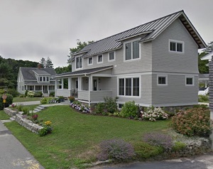
An image of South Portland
More city maps of Maine:
- Map of Brunswick
Brunswick, Maine is a lovely town situated in Cumberland County. Incorporated back in 1739, today ... - Map of Gorham
Gorham, Maine is a wonderful town located in Cumberland County. It stands just west of the city of... - Map of Kennebunk
Kennebunk, Maine is a wonderful town located in York County. It stands on the northeastern coast o... - Map of Lisbon
Lisbon, Maine is a beautiful town located in Androscoggin County. It nests along the Androscoggin ... - Map of Yarmouth
Yarmouth, Maine is a nice town located in Cumberland County, along the northern edge of Casco Bay... - Map of Ellsworth
The city of Ellsworth, Maine is the county seat of Hancock County. It stands along the Union River... - Map of Winslow
Winslow, Maine is a wonderful town situated along the Kennebec River in Kennebec County. Today Win... - Map of Caribou
Caribou, Maine is a pleasant town standing upon Aroostook River in Aroostook County. The populatio... - Map of Hermon
Hermon, Maine is a charming town located in Penobscot County. Today Hermon is home to 6 thousand r... - Map of Poland
Poland, Maine is a nice town situated in Androscoggin County. Today Poland is populated by 6 thous... - Map of Paris
Paris, Maine is a wonderful town situated in (and county seat of) Oxford County. Today Paris is po... - Map of Sabattus
Sabattus, Maine is a pleasant town found in Androscoggin County. The population of Sabattus exceed...
This online map of South Portland, Maine is provided by Bing Maps. Please add a bookmark and share the page with your friends!