Montgomery County on the map of Missouri 2026. Cities, roads, borders and directions in Montgomery County of Missouri.
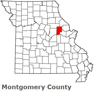
USA / Missouri / Montgomery CountyMontgomery County is found in the eastern region of Missouri. This amazing county is named after Richard Montgomery (1738–1775), an Irish-born soldier. The overall population of Montgomery County reaches 11 thousand people. The county, organized in 1818, covers an area of 539 square miles. The county seat of Montgomery County is Montgomery City. This map shows the borders of Montgomery County as well as neighboring counties, including major highways and natural objecsts as of 2026. Zoom in or out of the map using the plus/minus panel. Move the center of this map by dragging it. Also check out the satellite map of Montgomery County.
The borders of Montgomery County over the map of Missouri
Explore some more counties of Missouri:
- Wright County
- Worth County
- Webster County
- Wayne County
- Washington County
- Warren County
- Vernon County
- Texas County
- Taney County
- Sullivan County
- Stone County
- Stoddard County
- Shelby County
- Shannon County
- Scott County
- Scotland County
- Schuyler County
- Saline County
- Sainte Genevieve County
- Saint Francois County
Full list of Missouri maps
This online map of Montgomery County, Missouri is provided by Bing Maps. Please add a bookmark and share the page with your friends!
© 2026 City maps and famous places