Morgan County on the map of Missouri 2026. Cities, roads, borders and directions in Morgan County of Missouri.
USA / Missouri / Morgan CountyMorgan County is situated in the central area of Missouri. This particular county is named after Daniel Morgan (c. 1736–1802), American pioneer, soldier, and United States Representative from Virginia. The total area of Morgan County is about 598 square miles. This county, set up in 1833, is populated today by at least 21 thousand residents. Versailles is the county seat of Morgan County. This map shows the borders of Morgan County as well as neighboring counties, including major highways and natural objecsts as of 2026. Zoom in or out of the map using the plus/minus panel. Move the center of this map by dragging it. Also check out the satellite map of Morgan County.
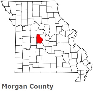
The borders of Morgan County over the map of Missouri
Explore some more counties of Missouri:
- Wright County
- Worth County
- Webster County
- Wayne County
- Washington County
- Warren County
- Vernon County
- Texas County
- Taney County
- Sullivan County
- Stone County
- Stoddard County
- Shelby County
- Shannon County
- Scott County
- Scotland County
- Schuyler County
- Saline County
- Sainte Genevieve County
- Saint Francois County
Full list of Missouri maps
This online map of Morgan County, Missouri is provided by Bing Maps. Please add a bookmark and share the page with your friends!
© 2026 City maps and famous places