Coryell County on the map of Texas 2026. Cities, roads, borders and directions in Coryell County of Texas.
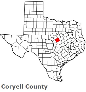
USA / Texas / Coryell CountyCoryell County is situated in the central region of Texas. This beautiful county is named after James Coryell, a frontiersman and Texas Ranger who was killed by Native Americans. The total area of Coryell County is about 1052 square miles. This county, created in 1854, is populated today by at least 84 thousand residents. Gatesville is the county seat of Coryell County. This map shows the borders of Coryell County as well as neighboring counties, including major highways and natural objecsts as of 2026. Zoom in or out of the map using the plus/minus panel. Move the center of this map by dragging it. Also check out the satellite map of Coryell County.
The borders of Coryell County over the map of Texas
Explore some more counties of Texas:
- Zavala County
- Zapata County
- Young County
- Yoakum County
- Wood County
- Wise County
- Winkler County
- Wilson County
- Williamson County
- Willacy County
- Wilbarger County
- Wichita County
- Wheeler County
- Wharton County
- Webb County
- Washington County
- Ward County
- Waller County
- Walker County
- Victoria County
Full list of Texas maps
This online map of Coryell County, Texas is provided by Bing Maps. Please add a bookmark and share the page with your friends!
© 2026 City maps and famous places