Matagorda County on the map of Texas 2026. Cities, roads, borders and directions in Matagorda County of Texas.
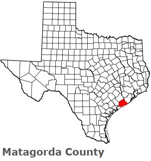
USA / Texas / Matagorda CountyMatagorda County is found in the coastal region of Texas. This proud county is named after The canebrakes which once grew along the coast (Mata gorda is Spanish for fat bush). The population of Matagorda County reaches 36 thousand people. The county, formed in 1836, covers an area of 1114 square miles. The county seat of Matagorda County is Bay City. This map shows the borders of Matagorda County as well as neighboring counties, including major highways and natural objecsts as of 2026. Zoom in or out of the map using the plus/minus panel. Move the center of this map by dragging it. Also check out the satellite map of Matagorda County.
The borders of Matagorda County over the map of Texas
Explore some more counties of Texas:
- Zavala County
- Zapata County
- Young County
- Yoakum County
- Wood County
- Wise County
- Winkler County
- Wilson County
- Williamson County
- Willacy County
- Wilbarger County
- Wichita County
- Wheeler County
- Wharton County
- Webb County
- Washington County
- Ward County
- Waller County
- Walker County
- Victoria County
Full list of Texas maps
This online map of Matagorda County, Texas is provided by Bing Maps. Please add a bookmark and share the page with your friends!
© 2026 City maps and famous places