Garfield County on the map of Washington 2026. Cities, roads, borders and directions in Garfield County of Washington.
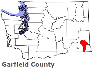
USA / Washington / Garfield CountyGarfield County is situated in the southeastern corner of the state of Washington. This amazing county is named after James A. Garfield (1831-1881), 20th U.S. President. The area of Garfield County is about 710 square miles. This county, set up in 1881, is populated today by 2 thousand residents. Pomeroy is the county seat of Garfield County. This map shows the borders of Garfield County as well as neighboring counties, including major highways and natural objecsts as of 2026. Zoom in or out of the map using the plus/minus panel. Move the center of this map by dragging it. Also check out the satellite map of Garfield County.
The borders of Garfield County over the map of Washington
Explore some more counties of Washington:
- Yakima County
- Whitman County
- Whatcom County
- Walla Walla County
- Wahkiakum County
- Thurston County
- Stevens County
- Spokane County
- Skamania County
- Skagit County
- San Juan County
- Pend Oreille County
- Pacific County
- Okanogan County
- Mason County
- Lincoln County
- Lewis County
- Klickitat County
- Kittitas County
- Kitsap County
Full list of Washington maps
This online map of Garfield County, Washington is provided by Bing Maps. Please add a bookmark and share the page with your friends!
© 2026 City maps and famous places