City maps, satellite images and cool places
Hello and welcome! The site is about city maps, famous places and interesting videos. Enjoy the voyage!
Find a city, a county, a state or a landmark:Saturday, September 20, 2025 — check out some trending news:
- Cool facts about Bhutan
- What is Bhutan famous for?
- What language do they speak in Bhutan?
- Is Bhutan expensive to travel to?
- What’s the best time to visit Bhutan?
- Do you need a visa to visit Bhutan?
- Why is Bhutan called the happiest country?
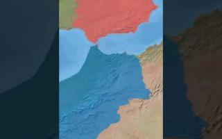
- Where exactly is Bhutan?
- Cool facts about Monte-Carlo
- How do you get to Monte-Carlo?
- Is Monte-Carlo safe for tourists?
- What can you do in Monte-Carlo besides gambling?
- Do you need a passport to visit Monte-Carlo?
- What’s the best time to go to Monte-Carlo?
- Can you visit Monte-Carlo on a budget?
- Why is Monte-Carlo so popular?
- Is Monte-Carlo the capital of Monaco?
- Where exactly is Monte-Carlo?
- Cool facts about El Salvador
- What are some must-see attractions in El Salvador?
- Is El Salvador safe for travelers?
- What language is spoken in El Salvador?
- What currency is used in El Salvador?
- Do I need a visa to visit El Salvador?
- What is the best time to visit El Salvador?
- Cool facts about Mongolia
- What are some must-see attractions in Mongolia?
- How do I get around Mongolia?
- What should I pack for a trip to Mongolia?
- Is Mongolia safe for travelers?
- What language is spoken in Mongolia?
- What currency is used in Mongolia?
- Do I need a visa to visit Mongolia?
- What is the best time to visit Mongolia?
- Cool facts about Iceland
- What are some must-see attractions in Iceland?
- When is the best time to visit Iceland?
- How do I get around Iceland?
- What should I pack for a trip to Iceland?
- Is Iceland safe for travelers?
- What language is spoken in Iceland?
- What currency is used in Iceland?
- Do I need a visa to visit Iceland?
- Cool facts about Moldova
- What should I know about Moldovan cuisine?
- How do I get around Moldova?
- What is the best time to visit Moldova?
- What are the must-see attractions in Moldova?
- Is Moldova safe for travelers?
- What language is spoken in Moldova?
- What currency is used in Moldova?
- Do I need a visa to visit Moldova?
- Cool facts about Lake Constance
- Do I need a visa to visit Lake Constance?
- When is the best time to visit Lake Constance?
Top-20 popular landmarks on our site
- Mar-a-Lago
- Area 51
- Mekong River
- Europe-Asia Border
- Jericho city
- Novo Mesto
- Snailbrook
- Uzbekistan
- Hard Rock Stadium
- Dubai
- Truist Park
- Yale University
- Scotland Yard
- Mont Blanc
- Panama Canal
- East River
- Rogers Centre
- Greenland
- Babylon
- The Pentagon
City maps by country
The Shooting Range of America:Alabama | Alaska | Arizona | Arkansas | California | Colorado | Connecticut | Delaware | DC | Florida | Georgia | Hawaii | Idaho | Illinois | Indiana | Iowa | Kansas | Kentucky | Louisiana | Maine | Maryland | Massachusetts | Michigan | Minnesota | Mississippi | Missouri | Montana | Nebraska | Nevada | New Hampshire | New Jersey | New Mexico | New York | North Carolina | North Dakota | Ohio | Oklahoma | Oregon | Pennsylvania | Rhode Island | South Carolina | South Dakota | Tennessee | Texas | Utah | Vermont | Virginia | Washington | West Virginia | Wisconsin | Wyoming
The New World:
Canada | Mexico | Puerto Rico | Brazil | Chile | Peru | Argentina
The Anglo-Saxons:
United Kingdom | Australia | Ireland | New Zealand
The Neanderthals:
Germany | France | Italy | Greece | Spain | Portugal | Switzerland | Belgium | Netherlands | Austria | Czechia | Slovakia | Hungary | Poland | Ukraine | Romania | Moldova | Latvia | Lithuania | Estonia | Finland | Sweden | Denmark | Norway
The Silk Way:
Kazakhstan | Kyrgyzstan | Uzbekistan | Tajikistan | Pakistan | Georgia | Armenia | Turkey | UAE | Qatar | Saudi Arabia | Yemen | Syria
The Eastern Belt:
Japan | China | India
The Chosen Ones:
Israel | Palestine
Top videos:


Recently added city maps:
- Bigfork, MT, USA
(street map | satellite map | population | weather)
Bigfork, Montana is a scenic CDP located in Flathead County. Today Bigfork is home to 5.2 thousand residents. - Hamilton, MT, USA
(street map | satellite map | population | weather)
Hamilton, Montana is a charming city acting as the county seat of Ravalli County. Today Hamilton is populated by 5.3 thousand souls. - Orchard Homes, MT, USA
(street map | satellite map | population | weather)
Orchard Homes, Montana is a small CDP in Missoula County. The population of Orchard Homes exceeds 5.3 thousand people. - Four Corners, MT, USA
(street map | satellite map | population | weather)
Four Corners, Montana is a CDP located in Gallatin County. Today Four Corners is home to 5.6 thousand residents. - Polson, MT, USA
(street map | satellite map | population | weather)
Polson is a beautiful city situated in Lake County of western Montana. Today Polson is populated by 5.6 thousand souls. - Columbia Falls, MT, USA
(street map | satellite map | population | weather)
Columbia Falls, Montana is an extraordinary city in Flathead County. The population of Columbia Falls exceeds 5.7 thousand people. - Sidney, MT, USA
(street map | satellite map | population | weather)
Sidney, Montana is an adorable city serving as the county seat of Richland County. Today Sidney is home to 6.1 thousand residents. - Lewistown, MT, USA
(street map | satellite map | population | weather)
Lewistown, Montana is a wonderful city acting as the county seat of Fergus County. Today Lewistown is populated by 6.1 thousand souls. - Laurel, MT, USA
(street map | satellite map | population | weather)
Laurel, Montana is a charming city in Yellowstone County. The population of Laurel exceeds 7.2 thousand people. - Lockwood, MT, USA
(street map | satellite map | population | weather)
Lockwood, Montana is a small CDP located in Yellowstone County. Today Lockwood is home to 7.5 thousand residents. - Helena Valley West Central, MT, USA
(street map | satellite map | population | weather)
Helena Valley West Central, Montana is a CDP situated in Lewis and Clark County. Today Helena Valley West Central is populated by 8.2 thousand souls. - Miles City, MT, USA
(street map | satellite map | population | weather)
Miles City, Montana is a beautiful city in Custer County. The population of Miles City exceeds 8.4 thousand people. - Evergreen, MT, USA
(street map | satellite map | population | weather)
Evergreen, Montana is a CDP located in Flathead County. Today Evergreen is home to 8.9 thousand residents. - Livingston, MT, USA
(street map | satellite map | population | weather)
Livingston, Montana is an adorable city serving as the county seat of Park County. Today Livingston is populated by 8.9 thousand souls. - Whitefish, MT, USA
(street map | satellite map | population | weather)
Whitefish, Montana is a wonderful resort city in Flathead County. The population of Whitefish exceeds 9.2 thousand people. - Havre, MT, USA
(street map | satellite map | population | weather)
Havre, Montana is a charming city serving as the county seat for Hill County. Today Havre is home to 9.3 thousand residents. - Helena Valley Southeast, MT, USA
(street map | satellite map | population | weather)
Helena Valley Southeast, Montana is a small CDP situated in Lewis and Clark County. Today Helena Valley Southeast is populated by 9.5 thousand souls. - Anaconda, MT, USA
(street map | satellite map | population | weather)
Anaconda, Montana is a lovely city in Deer Lodge County. The population of Anaconda exceeds 9.7 thousand people. - Belgrade, MT, USA
(street map | satellite map | population | weather)
Belgrade, Montana is a beautiful city located in Gallatin County. Today Belgrade is home to 12.5 thousand residents. - Ashland, MO, USA
(street map | satellite map | population | weather)
Ashland, Missouri is a lovely city situated in Boone County. Today Ashland is populated by 5 thousand souls.
Some cool places on our planet:
- Camp Mystic (satellite map)
Camp Mystic Cypress Lake is located in central Texas, about 80 mines northwest of San Antonio. - Sandy Cay Reef (satellite map)
Sandy Cay Reef is located in South China Sea. It consists of multiple shallow reefs with dynamic sandbanks. Sandy Cay Reef is claimed by China, the Philippines, Taiwan, and Vietnam. - Saint Martha House (satellite map)
Saint Martha House (Casa Santa Marta / Domus Sanctae Marthae) is a residential building in Vatican. It was built in 1996 as a guesthouse. The Pope Francis lived here until his death in April, 2025. - One Seaport (satellite map)
161 Maiden Lane, also known as One Seaport, is an unfinished skyscraper located in the financial district of Manhattan. The tower is leaning by 3 inches and its construction is paused. - Bougainville (satellite map)
The Autonomous Region of Bougainville is a region in Papua New Guinea, seeking independence. It's located on a pair of small islands in South Pacific, northeast of Australia. - T4 Airbase (satellite map)
Tiyas (T4) Air Base is a military airbase located in central Syria, near the ancient city of Palmyra. T4 is the largest airbase in Syria. - Heard Island (satellite map)
Heard Island and McDonald Islands is an Australian external territory located in the Southern Ocean, about two-thirds of the way from Madagascar to Antarctica. Watch the video: The untouched beauty of Heard and McDonald Islands. - Istanbul Canal (satellite map)
Istanbul Canal is an artificial canal being dug to the west of Istanbul to make the marine traffic in the Bosphorus less crazy. When complete, Istanbul Canal will turn the western side of Istanbul into an island. - Yonaguni Monument (satellite map)
Yonaguni Monument is an undersea structure located east of Taiwan, off the coast of Yonaguni island, Japan. It is a very unusual rock formation, and some people believe that it belongs to an ancient civilization. - Lac la Ronge (satellite map)
Lac la Ronge is a beautiful water reservoir found in Saskatchewan, Canada. It is the 35-th biggest lake in Canada in terms of area, covering about 1,413 square kilometers. - Cree Lake (satellite map)
Cree Lake is a wonderful water area located in Saskatchewan, Canada. This famous lake has a total area of 1,434 square kilometers, which places it on the 34-th place in the list of largest lakes in Canada by area. - Lake Claire (satellite map)
Lake Claire is a famous water resource situated in Alberta, Canada. Lake Lake Claire covers an area of 1,436 square kilometers, which makes it the 33-th largest lake in Canada in terms of area. - Yathkyed Lake (satellite map)
Yathkyed Lake is a large fresh water body found in Nunavut, Canada. It is the 32-th biggest lake in Canada in terms of area, spanning about 1,449 square kilometers. - Gouin Reservoir (satellite map)
Gouin Reservoir is a big water reservoir located in Quebec, Canada. This famous lake has a total area of 1,570 square kilometers, which places it on the 31-th place in the list of largest lakes in Canada by area. - Lac Seul (satellite map)
Lac Seul is a big fresh water body situated in Ontario, Canada. Lake Lac Seul covers an area of 1,657 square kilometers, which makes it the 30-th largest lake in Canada in terms of area. - Williston Lake (satellite map)
Williston Lake is a beautiful water reservoir found in British Columbia, Canada. It is the 29-th biggest lake in Canada in terms of area, spanning about 1,761 square kilometers. - Lac La Martre (satellite map)
Lac La Martre is a wonderful water area located in Northwest Territories, Canada. This famous lake has a total area of 1,778 square kilometers, which places it on the 28-th place in the list of largest lakes in Canada by area. - Baker Lake (satellite map)
Baker Lake is a famous water resource situated in Nunavut, Canada. Lake Baker Lake covers an area of 1,887 square kilometers, which makes it the 27-th largest lake in Canada in terms of area. - Manicouagan Reservoir (satellite map)
Manicouagan Reservoir is a large ring-shaped water body found in Quebec, Canada. It is the 26-th biggest lake in Canada in terms of area, spanning about 1,973 square kilometers. - Southern Indian Lake (satellite map)
Southern Indian Lake is a big water reservoir located in Manitoba, Canada. This famous lake has a total area of 2,247 square kilometers, which places it on the 25-th place in the list of largest lakes in Canada by area. - Nueltin Lake (satellite map)
Nueltin Lake is a famous water resource situated in Nunavut, Canada. Lake Nueltin Lake covers an area of 2,279 square kilometers, which makes it the 24-th largest lake in Canada in terms of area. - Lake Mistassini (satellite map)
Lake Mistassini (Lac Mistassini in French) is a large water lake found in Quebec, Canada. It is the 23-th biggest lake in Canada in terms of area, spanning about 2,335 square kilometers. - La Grande 3 Reservoir (satellite map)
La Grande 3 Reservoir is a man-made water resource located in Quebec, Canada. This famous lake has a total area of 2,536 square kilometers, which places it on the 22-th place in the list of largest lakes in Canada by area. - Wollaston Lake (satellite map)
Wollaston Lake is a famous water resource situated in Saskatchewan, Canada. Lake Wollaston Lake covers an area of 2,681 square kilometers, which makes it the 21-th largest lake in Canada in terms of area. - Robert-Bourassa Reservoir (satellite map)
Robert-Bourassa Reservoir is a large water body in Quebec, Canada. It is the 20-th biggest lake in Canada in terms of area, spanning about 2,815 square kilometers. - Caniapiscau Reservoir (satellite map)
Caniapiscau Reservoir is a big water reservoir located in Quebec, Canada. This famous lake has a total area of 4,318 square kilometers, which places it on the 15-th place in the list of largest lakes in Canada by area. - Smallwood Reservoir (satellite map)
Smallwood Reservoir is situated in the western part of Labrador, Canada. It's named after Joey Smallwood, the first premier of Newfoundland. - Toronto Pearson Airport (satellite map)
Toronto Pearson International Airport (IATA code: YYZ) is located on the western outskirts of Toronto, Canada. Toronto Pearson is the main air hub serving Toronto metro area and the nearby cities. - Johnson South Reef (satellite map)
Johnson South Reef, also known as Chigua Jiao (赤瓜礁), is a small island located in the southern part of South China Sea. The island is controlled by the Chinese, but claimed by Taiwan, Philippines and Vietnam. - Cuarteron Reef (satellite map)
Cuarteron Reef AKA Huayang Reef is a small reef located in the southern part of South China Sea. De-facto controlled by China, Cuarteron Reef is also claimed by the Philippines, Taiwan and Vietnam. - Newgrange (satellite map)
The prehistoric Newgrange monument is located in eastern Ireland, in County Meath. It is believed to be constructed as eary as 3200 BC. - Bermuda triangle (satellite map)
Bermuda triangle is located in the northern Atlantic, just outside the Caribbean sea. Bermuda triangle is famous as a misterious place where many ships and planes have dissappeared for no reason.
Watch the video: The Mystery of Bermuda Triangle
- Stanford University (satellite map)
Stanford University is located in Stanford, California. It is one of the most distinguished universities not only in the United States, but in the whole World. The exact address is: 450 Serra Mall, Stanford, CA 94305. Call (650) 723-2300 for additional info. - Neuschwanstein Castle (satellite map)
Neuschwanstein Castle is located in southern Germany, near the city of Füssen. Built in 1892 by Ludwig II of Bavaria, Neuschwanstein is one of the most famous castles in the World. - The Guggenheim (satellite map)
Solomon R Guggenheim Museum is located on 5th Avenue, Manhattan, NYC. It is one of the famous art museums in the World. Its spiral shaped building is one of the best known landmarks of New York City.
Watch the video: A Guide to The Guggenheim museum
- Faroe Islands (satellite map)
Faroe Islands are located on the northern edge of the Atlantic ocean, about 200 miles north to the British island. It is an independent country under the Danish Realm. - Burkina Faso (satellite map)
Burkina Faso, formerly known as The Upper Volta, is a landlocked country located in West Africa. Independent from France since 1960, Burkina Faso is still a politically unstable country. The population of Burkina Faso is about 17 million people and the GDP per capita is as low as $1,700. - Guantanamo (satellite map)
Guantanamo is located on the southern coast of Cuba and maintained by the US for a rent. This city's main feature is a military base owned by the US government. Guantanamo also has a top security prison for most dangerous criminals. - Tajikistan (satellite map)
Tajikistan is a landlocked country located in the central part of Asia. It is a former USSR republic, now ruled by a typical post-soviet dictator. The capital city of Tajikistan is Dushanbe. - Fallujah (satellite map)
The city of Al-Fallujah is located in central Iraq, only 35 miles west to Baghdad. Al-Fallujah was a scene of severe fighting between ISIS and the Iraqi Army in 2016. The population of Fallujah is estimated at 350 thousand people. - The Gambia (satellite map)
The Gambia is located in West Africa. This small country is locked by the territory of Senegal and the Atlantic coast. The country gained independence from Great Britain in 1965. The capital city of The Gambia is Banjul. The population of Gambia is only about 2 million people. - Dominica (satellite map)
Dominica is a country located on a small island on the eastern edge of the Caribbean. This country sould not be confused with Dominican republic. - Guinea (satellite map)
Guinea is a French speaking country in western Africa with 13 million inhabitants. The Capital city of Guinea and the largest one is Conakry. - Daegu (satellite map)
Daegu is located in South Korea, about 150 miles south-east from Seoul. Daegu is a large and modern city with nearly 2.5 million inhabitants, which makes it the fourth-largest city in South Korea.. - Japan National Stadium (satellite map)
Japan National Stadium is located in Shinjuku special ward of Tokyo Japan. The exact address of the stadium is: 10-2, Kasumigaoka-machi, Shinjuku, Tokyo. The closest subway station to the stadium is Kokuritsu-Kyōgijō, which means national stadium in Japanese. This venue is expected to host the 2021 summer Olympics opening ceremony. - Badakhshan (satellite map)
Badakhshan is a province of Afghanistan, located in the northern part of the country, the one that borders Tajikistan. The population of Badassan exceeds 1 million people and the capital city is Fayzabad. - Pelee Island (satellite map)
Pelee Island is located in the western part of Lake Erie. It belongs to Ontario province, Canada. Pelee Island is the southernmost populated place in Canada. Its total area is about 42 square kilometres. - Melbourne Park (satellite map)
Melbourne Park is a large complex of sports venues located in downtown Melbourne, Australia. It hosts the famous Australian Open tennis tournament. - ByWard Market (satellite map)
ByWard Market is a famous historic neighborhood located to the east of Downtown Ottawa, Canada. - New York City Hall (satellite map)
New York City Hall is located in City Hall Park, Lower Manhattan. Built in 1812 by Joseph-François Mangin and John McComb Jr., it still keeps functioning as a government house.
Some useful locations in US cities:
- Landmarks in Bellevue, Washington
- Landmarks in Chesapeake, Virginia
- Landmarks in Vancouver, Washington
- Landmarks in Tacoma, Washington
- Landmarks in Seattle, Washington
- Landmarks in Charleston, West Virginia
- Landmarks in Milwaukee, Wisconsin
- Landmarks in Cheyenne, Wyoming
- Landmarks in Providence, Rhode Island
- Landmarks in Pittsburgh, Pennsylvania
- Landmarks in Philadelphia, Pennsylvania
- Landmarks in Memphis, Tennessee
- Landmarks in Nashville, Tennessee
- Landmarks in Reno, Nevada
- Landmarks in Lincoln, Nebraska
- Landmarks in St. Louis, Missouri
- Landmarks in Eugene, Oregon
- Landmarks in Portland, Oregon
- Landmarks in Tulsa, Oklahoma
- Landmarks in Oklahoma City, Oklahoma
- Landmarks in Cleveland, Ohio
- Landmarks in Columbus, Ohio
- Landmarks in Charlotte, North Carolina
- Landmarks in Albuquerque, New Mexico
- Landmarks in Jersey City, New Jersey
- Landmarks in Newark, New Jersey
- Landmarks in Manchester, New Hampshire
- Landmarks in Henderson, Nevada
- Landmarks in Las Vegas, Nevada
- Landmarks in Omaha, Nebraska
- Landmarks in Billings, Montana
- Landmarks in Kansas City, Missouri
- Landmarks in Jackson, Mississippi
- Landmarks in Minneapolis, Minnesota
- Landmarks in Grand Rapids, Michigan
- Landmarks in Worcester, Massachusetts
- Landmarks in Germantown, Maryland
- Landmarks in Detroit, Michigan
- Landmarks in Boston, Massachusetts
- Landmarks in Columbia, Maryland
- Landmarks in Baltimore, Maryland
- Landmarks in Portland, Maine
- Landmarks in Shreveport, Louisiana
- Landmarks in Baton Rouge, Louisiana
- Landmarks in New Orleans, Louisiana
- Landmarks in Bowling Green, Kentucky
- Landmarks in Lexington, Kentucky
- Landmarks in Louisville, Kentucky
- Landmarks in Overland Park, Kansas
- Landmarks in Wichita, Kansas
Some ZIP codes in the US:
- ZIP code 07799 (Eatontown, New Jersey)
- ZIP code 07999 (Whippany, New Jersey)
- ZIP code 20799 (Capitol Heights, Maryland)
- ZIP code 31799 (Thomasville, Georgia)
- ZIP code 32799 (Mid Florida, Florida)
- ZIP code 37995 (Knoxville, Tennessee)
- ZIP code 37996 (Knoxville, Tennessee)
- ZIP code 37997 (Knoxville, Tennessee)
- ZIP code 37998 (Knoxville, Tennessee)
- ZIP code 44799 (Canton, Ohio)
- ZIP code 46799 (Zanesville, Indiana)
- ZIP code 47990 (Waynetown, Indiana)
- ZIP code 47991 (West Lebanon, Indiana)
- ZIP code 47992 (Westpoint, Indiana)
- ZIP code 47993 (Williamsport, Indiana)
- ZIP code 47994 (Wingate, Indiana)
- ZIP code 47995 (Wolcott, Indiana)
- ZIP code 47996 (West Lafayette, Indiana)
- ZIP code 47997 (Yeoman, Indiana)
- ZIP code 49799 (Wolverine, Michigan)
- ZIP code 57799 (Spearfish, South Dakota)
- ZIP code 61799 (Bloomington, Illinois)
- ZIP code 75799 (Tyler, Texas)
- ZIP code 76799 (Waco, Texas)
- ZIP code 77990 (Tivoli, Texas)
- ZIP code 77991 (Vanderbilt, Texas)
- ZIP code 77993 (Weesatche, Texas)
- ZIP code 77994 (Westhoff, Texas)
- ZIP code 77995 (Yoakum, Texas)
- ZIP code 78799 (Austin, Texas)
- ZIP code 79901 (El Paso, Texas)
- ZIP code 79902 (El Paso, Texas)
- ZIP code 79903 (El Paso, Texas)
- ZIP code 79904 (El Paso, Texas)
- ZIP code 79905 (El Paso, Texas)
- ZIP code 79906 (El Paso, Texas)
- ZIP code 79907 (El Paso, Texas)
- ZIP code 79908 (El Paso, Texas)
- ZIP code 79910 (El Paso, Texas)
- ZIP code 79911 (El Paso, Texas)
- ZIP code 79912 (El Paso, Texas)
- ZIP code 79913 (El Paso, Texas)
- ZIP code 79914 (El Paso, Texas)
- ZIP code 79915 (El Paso, Texas)
- ZIP code 79916 (Fort Bliss, Texas)
- ZIP code 79917 (El Paso, Texas)
- ZIP code 79918 (Fort Bliss, Texas)
- ZIP code 79920 (El Paso, Texas)
- ZIP code 79922 (El Paso, Texas)
- ZIP code 79923 (El Paso, Texas)
- ZIP code 79924 (El Paso, Texas)
- ZIP code 79925 (El Paso, Texas)
- ZIP code 79926 (El Paso, Texas)
- ZIP code 79927 (El Paso, Texas)
- ZIP code 79928 (El Paso, Texas)
- ZIP code 79929 (El Paso, Texas)
- ZIP code 79930 (El Paso, Texas)
- ZIP code 79931 (El Paso, Texas)
- ZIP code 79932 (El Paso, Texas)
- ZIP code 79934 (El Paso, Texas)
- ZIP code 79935 (El Paso, Texas)
- ZIP code 79936 (El Paso, Texas)
- ZIP code 79937 (El Paso, Texas)
- ZIP code 79938 (El Paso, Texas)
- ZIP code 79940 (El Paso, Texas)
- ZIP code 79941 (El Paso, Texas)
- ZIP code 79942 (El Paso, Texas)
- ZIP code 79943 (El Paso, Texas)
- ZIP code 79944 (El Paso, Texas)
- ZIP code 79945 (El Paso, Texas)
- ZIP code 79946 (El Paso, Texas)
- ZIP code 79947 (El Paso, Texas)
- ZIP code 79948 (El Paso, Texas)
- ZIP code 79949 (El Paso, Texas)
- ZIP code 79950 (El Paso, Texas)
- ZIP code 79951 (El Paso, Texas)
- ZIP code 79952 (El Paso, Texas)
- ZIP code 79953 (El Paso, Texas)
- ZIP code 79954 (El Paso, Texas)
- ZIP code 79955 (El Paso, Texas)
- ZIP code 79958 (El Paso, Texas)
- ZIP code 79960 (El Paso, Texas)
- ZIP code 79961 (El Paso, Texas)
- ZIP code 79968 (El Paso, Texas)
- ZIP code 79976 (El Paso, Texas)
- ZIP code 79978 (El Paso, Texas)
- ZIP code 79980 (El Paso, Texas)
- ZIP code 79990 (El Paso, Texas)
- ZIP code 79995 (El Paso, Texas)
- ZIP code 79996 (El Paso, Texas)
- ZIP code 79997 (El Paso, Texas)
- ZIP code 79998 (El Paso, Texas)
- ZIP code 79999 (El Paso, Texas)
- ZIP code 83799 (Boise, Idaho)
- ZIP code 92799 (Santa Ana, California)
- ZIP code 95799 (West Sacramento, California)
This site is also available in:
- Spanish:
Mapas de las ciudades del mundo
- Buenos Aires, Argentina
- Córdoba, Argentina
- Ciudad de México, México
- Santiago, Chile
- Lima, Perú
- Bayamón, Puerto Rico
- San Juan, Puerto Rico
- Andorra la Vella, Andorra
- German:
Karten von Städten in der Welt
- Berlin
- Köln
- Hamburg
- München
- Frankfurt
- Stuttgart
- Bremen
- Dortmund
- Dresden
- Düsseldorf
- Essen
- Leipzig
- Bielefeld
- Hannover
- Mannheim
- Duisburg
- Nürnberg
- Bochum
- Wuppertal
- Bonn
- Karlsruhe
- Gelsenkirchen
- French:
Cartes des belles villes du monde
- Nice, France
- Toulouse, France
- Lyon, France
- Marseille, France
- Paris, France
- Winnipeg, Canada
- Québec, Canada
- Ottawa, Canada
- Edmonton, Canada
- Calgary, Canada
- Montréal, Canada
- Toronto, Canada
- Vancouver, Canada
- Lucerne, Suisse
- Winterthour, Suisse
- Lausanne, Suisse
- Berne, Suisse
- Genève, Suisse
- Zurich, Suisse
- Bâle, Suisse
- Bruges, Belgique
- Liège, Belgique
- Charleroi, Belgique
- Gand, Belgique
- Anvers, Belgique
- Bruxelles, Belgique
- Chinese:
世界上最大的城市的地图 - Japanese:
日本と世界の主要都市の地図 - Hebrew:
מפות של ערים בארץ ובעולם
© 2025 City maps and famous places