City maps, satellite images and cool places
Hello and welcome! The site is about city maps, famous places and interesting videos. Enjoy the voyage!
Find a city, a county, a state or a landmark:Sunday, August 17, 2025 — check out some trending news:
- Cool facts about La Scala
- Can tourists visit La Scala without attending a performance?
- What is the dress code at La Scala?
- Does La Scala have a museum?
- Has La Scala undergone renovations?
- How many people can La Scala theater hold?
- What types of performances are held at La Scala?
- Why is La Scala important in the world of opera?
- When was La Scala built?
- What is La Scala theater?
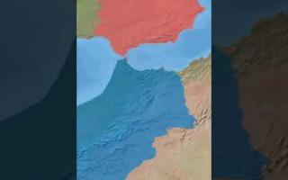
- Cool facts about Donbass region
- What is the cultural identity of Donbass?
- What are major cities in Donbass?
- Has Donbass experienced conflict?
- What languages are spoken in Donbass?
- Why is Donbass significant historically?
- What is Donbass known for economically?
- What is the population of Donbass?
- What is the Donbass region?
- Cool facts about Columbia University
- Is Columbia University involved in research?
- What notable alumni attended Columbia University?
- Can students study abroad at Columbia University?
- What is Columbia University known for?
- What programs does Columbia University offer?
- Cool facts about LaGuardia Airport
- Who manages LaGuardia Airport?
- Is LaGuardia Airport undergoing renovations?
- What facilities and services are available at LaGuardia Airport?
- What airlines operate at LaGuardia Airport?
- What is LaGuardia Airport?
- Cool facts about Mount Vernon
- Who manages Mount Vernon today?
- Can you visit Mount Vernon today?
- What is the historical significance of Mount Vernon?
- What can visitors see at Mount Vernon?
- What is Mount Vernon?
- Cool facts about Lake Titicaca
- Why is Lake Titicaca considered unique?
- What recreational activities can be done on Lake Titicaca?
- What wildlife is found in Lake Titicaca?
- Can you visit islands on Lake Titicaca?
- Why is Lake Titicaca important culturally?
- What is Lake Titicaca?
- Cool facts about the Sea of Galilee
- What wildlife can be found in the Sea of Galilee?
- Why is the Sea of Galilee important for Israel’s water supply?
- What towns and attractions are near the Sea of Galilee?
- Can you swim or boat in the Sea of Galilee?
- What is the religious significance of the Sea of Galilee?
- What is the Sea of Galilee?
- Cool facts about Taipei 101
- Who designed Taipei 101?
- What are the main uses of Taipei 101?
- Can visitors go to the observation deck?
Top-20 popular landmarks on our site
- Mar-a-Lago
- Area 51
- Mekong River
- Europe-Asia Border
- Jericho city
- Novo Mesto
- Snailbrook
- Uzbekistan
- Hard Rock Stadium
- Dubai
- Truist Park
- Yale University
- Scotland Yard
- Mont Blanc
- Panama Canal
- East River
- Rogers Centre
- Greenland
- Babylon
- The Pentagon
City maps by country
The Shooting Range of America:Alabama | Alaska | Arizona | Arkansas | California | Colorado | Connecticut | Delaware | DC | Florida | Georgia | Hawaii | Idaho | Illinois | Indiana | Iowa | Kansas | Kentucky | Louisiana | Maine | Maryland | Massachusetts | Michigan | Minnesota | Mississippi | Missouri | Montana | Nebraska | Nevada | New Hampshire | New Jersey | New Mexico | New York | North Carolina | North Dakota | Ohio | Oklahoma | Oregon | Pennsylvania | Rhode Island | South Carolina | South Dakota | Tennessee | Texas | Utah | Vermont | Virginia | Washington | West Virginia | Wisconsin | Wyoming
The New World:
Canada | Mexico | Puerto Rico | Brazil | Chile | Peru | Argentina
The Anglo-Saxons:
United Kingdom | Australia | Ireland | New Zealand
The Neanderthals:
Germany | France | Italy | Greece | Spain | Portugal | Switzerland | Belgium | Netherlands | Austria | Czechia | Slovakia | Hungary | Poland | Ukraine | Romania | Moldova | Latvia | Lithuania | Estonia | Finland | Sweden | Denmark | Norway
The Silk Way:
Kazakhstan | Kyrgyzstan | Uzbekistan | Tajikistan | Pakistan | Georgia | Armenia | Turkey | UAE | Qatar | Saudi Arabia | Yemen | Syria
The Eastern Belt:
Japan | China | India
The Chosen Ones:
Israel | Palestine
Top videos:


Recently added city maps:
- Bigfork, MT, USA
(street map | satellite map | population | weather)
Bigfork, Montana is a scenic CDP located in Flathead County. Today Bigfork is home to 5.2 thousand residents. - Hamilton, MT, USA
(street map | satellite map | population | weather)
Hamilton, Montana is a charming city acting as the county seat of Ravalli County. Today Hamilton is populated by 5.3 thousand souls. - Orchard Homes, MT, USA
(street map | satellite map | population | weather)
Orchard Homes, Montana is a small CDP in Missoula County. The population of Orchard Homes exceeds 5.3 thousand people. - Four Corners, MT, USA
(street map | satellite map | population | weather)
Four Corners, Montana is a CDP located in Gallatin County. Today Four Corners is home to 5.6 thousand residents. - Polson, MT, USA
(street map | satellite map | population | weather)
Polson is a beautiful city situated in Lake County of western Montana. Today Polson is populated by 5.6 thousand souls. - Columbia Falls, MT, USA
(street map | satellite map | population | weather)
Columbia Falls, Montana is an extraordinary city in Flathead County. The population of Columbia Falls exceeds 5.7 thousand people. - Sidney, MT, USA
(street map | satellite map | population | weather)
Sidney, Montana is an adorable city serving as the county seat of Richland County. Today Sidney is home to 6.1 thousand residents. - Lewistown, MT, USA
(street map | satellite map | population | weather)
Lewistown, Montana is a wonderful city acting as the county seat of Fergus County. Today Lewistown is populated by 6.1 thousand souls. - Laurel, MT, USA
(street map | satellite map | population | weather)
Laurel, Montana is a charming city in Yellowstone County. The population of Laurel exceeds 7.2 thousand people. - Lockwood, MT, USA
(street map | satellite map | population | weather)
Lockwood, Montana is a small CDP located in Yellowstone County. Today Lockwood is home to 7.5 thousand residents. - Helena Valley West Central, MT, USA
(street map | satellite map | population | weather)
Helena Valley West Central, Montana is a CDP situated in Lewis and Clark County. Today Helena Valley West Central is populated by 8.2 thousand souls. - Miles City, MT, USA
(street map | satellite map | population | weather)
Miles City, Montana is a beautiful city in Custer County. The population of Miles City exceeds 8.4 thousand people. - Evergreen, MT, USA
(street map | satellite map | population | weather)
Evergreen, Montana is a CDP located in Flathead County. Today Evergreen is home to 8.9 thousand residents. - Livingston, MT, USA
(street map | satellite map | population | weather)
Livingston, Montana is an adorable city serving as the county seat of Park County. Today Livingston is populated by 8.9 thousand souls. - Whitefish, MT, USA
(street map | satellite map | population | weather)
Whitefish, Montana is a wonderful resort city in Flathead County. The population of Whitefish exceeds 9.2 thousand people. - Havre, MT, USA
(street map | satellite map | population | weather)
Havre, Montana is a charming city serving as the county seat for Hill County. Today Havre is home to 9.3 thousand residents. - Helena Valley Southeast, MT, USA
(street map | satellite map | population | weather)
Helena Valley Southeast, Montana is a small CDP situated in Lewis and Clark County. Today Helena Valley Southeast is populated by 9.5 thousand souls. - Anaconda, MT, USA
(street map | satellite map | population | weather)
Anaconda, Montana is a lovely city in Deer Lodge County. The population of Anaconda exceeds 9.7 thousand people. - Belgrade, MT, USA
(street map | satellite map | population | weather)
Belgrade, Montana is a beautiful city located in Gallatin County. Today Belgrade is home to 12.5 thousand residents. - Ashland, MO, USA
(street map | satellite map | population | weather)
Ashland, Missouri is a lovely city situated in Boone County. Today Ashland is populated by 5 thousand souls.
Some cool places on our planet:
- Camp Mystic (satellite map)
Camp Mystic Cypress Lake is located in central Texas, about 80 mines northwest of San Antonio. - Sandy Cay Reef (satellite map)
Sandy Cay Reef is located in South China Sea. It consists of multiple shallow reefs with dynamic sandbanks. Sandy Cay Reef is claimed by China, the Philippines, Taiwan, and Vietnam. - Saint Martha House (satellite map)
Saint Martha House (Casa Santa Marta / Domus Sanctae Marthae) is a residential building in Vatican. It was built in 1996 as a guesthouse. The Pope Francis lived here until his death in April, 2025. - One Seaport (satellite map)
161 Maiden Lane, also known as One Seaport, is an unfinished skyscraper located in the financial district of Manhattan. The tower is leaning by 3 inches and its construction is paused. - Bougainville (satellite map)
The Autonomous Region of Bougainville is a region in Papua New Guinea, seeking independence. It's located on a pair of small islands in South Pacific, northeast of Australia. - T4 Airbase (satellite map)
Tiyas (T4) Air Base is a military airbase located in central Syria, near the ancient city of Palmyra. T4 is the largest airbase in Syria. - Heard Island (satellite map)
Heard Island and McDonald Islands is an Australian external territory located in the Southern Ocean, about two-thirds of the way from Madagascar to Antarctica. Watch the video: The untouched beauty of Heard and McDonald Islands. - Istanbul Canal (satellite map)
Istanbul Canal is an artificial canal being dug to the west of Istanbul to make the marine traffic in the Bosphorus less crazy. When complete, Istanbul Canal will turn the western side of Istanbul into an island. - Yonaguni Monument (satellite map)
Yonaguni Monument is an undersea structure located east of Taiwan, off the coast of Yonaguni island, Japan. It is a very unusual rock formation, and some people believe that it belongs to an ancient civilization. - Lac la Ronge (satellite map)
Lac la Ronge is a beautiful water reservoir found in Saskatchewan, Canada. It is the 35-th biggest lake in Canada in terms of area, covering about 1,413 square kilometers. - Cree Lake (satellite map)
Cree Lake is a wonderful water area located in Saskatchewan, Canada. This famous lake has a total area of 1,434 square kilometers, which places it on the 34-th place in the list of largest lakes in Canada by area. - Lake Claire (satellite map)
Lake Claire is a famous water resource situated in Alberta, Canada. Lake Lake Claire covers an area of 1,436 square kilometers, which makes it the 33-th largest lake in Canada in terms of area. - Yathkyed Lake (satellite map)
Yathkyed Lake is a large fresh water body found in Nunavut, Canada. It is the 32-th biggest lake in Canada in terms of area, spanning about 1,449 square kilometers. - Gouin Reservoir (satellite map)
Gouin Reservoir is a big water reservoir located in Quebec, Canada. This famous lake has a total area of 1,570 square kilometers, which places it on the 31-th place in the list of largest lakes in Canada by area. - Lac Seul (satellite map)
Lac Seul is a big fresh water body situated in Ontario, Canada. Lake Lac Seul covers an area of 1,657 square kilometers, which makes it the 30-th largest lake in Canada in terms of area. - Williston Lake (satellite map)
Williston Lake is a beautiful water reservoir found in British Columbia, Canada. It is the 29-th biggest lake in Canada in terms of area, spanning about 1,761 square kilometers. - Lac La Martre (satellite map)
Lac La Martre is a wonderful water area located in Northwest Territories, Canada. This famous lake has a total area of 1,778 square kilometers, which places it on the 28-th place in the list of largest lakes in Canada by area. - Baker Lake (satellite map)
Baker Lake is a famous water resource situated in Nunavut, Canada. Lake Baker Lake covers an area of 1,887 square kilometers, which makes it the 27-th largest lake in Canada in terms of area. - Manicouagan Reservoir (satellite map)
Manicouagan Reservoir is a large ring-shaped water body found in Quebec, Canada. It is the 26-th biggest lake in Canada in terms of area, spanning about 1,973 square kilometers. - Southern Indian Lake (satellite map)
Southern Indian Lake is a big water reservoir located in Manitoba, Canada. This famous lake has a total area of 2,247 square kilometers, which places it on the 25-th place in the list of largest lakes in Canada by area. - Nueltin Lake (satellite map)
Nueltin Lake is a famous water resource situated in Nunavut, Canada. Lake Nueltin Lake covers an area of 2,279 square kilometers, which makes it the 24-th largest lake in Canada in terms of area. - Lake Mistassini (satellite map)
Lake Mistassini (Lac Mistassini in French) is a large water lake found in Quebec, Canada. It is the 23-th biggest lake in Canada in terms of area, spanning about 2,335 square kilometers. - La Grande 3 Reservoir (satellite map)
La Grande 3 Reservoir is a man-made water resource located in Quebec, Canada. This famous lake has a total area of 2,536 square kilometers, which places it on the 22-th place in the list of largest lakes in Canada by area. - Wollaston Lake (satellite map)
Wollaston Lake is a famous water resource situated in Saskatchewan, Canada. Lake Wollaston Lake covers an area of 2,681 square kilometers, which makes it the 21-th largest lake in Canada in terms of area. - Robert-Bourassa Reservoir (satellite map)
Robert-Bourassa Reservoir is a large water body in Quebec, Canada. It is the 20-th biggest lake in Canada in terms of area, spanning about 2,815 square kilometers. - Caniapiscau Reservoir (satellite map)
Caniapiscau Reservoir is a big water reservoir located in Quebec, Canada. This famous lake has a total area of 4,318 square kilometers, which places it on the 15-th place in the list of largest lakes in Canada by area. - Smallwood Reservoir (satellite map)
Smallwood Reservoir is situated in the western part of Labrador, Canada. It's named after Joey Smallwood, the first premier of Newfoundland. - Toronto Pearson Airport (satellite map)
Toronto Pearson International Airport (IATA code: YYZ) is located on the western outskirts of Toronto, Canada. Toronto Pearson is the main air hub serving Toronto metro area and the nearby cities. - Johnson South Reef (satellite map)
Johnson South Reef, also known as Chigua Jiao (赤瓜礁), is a small island located in the southern part of South China Sea. The island is controlled by the Chinese, but claimed by Taiwan, Philippines and Vietnam. - Cuarteron Reef (satellite map)
Cuarteron Reef AKA Huayang Reef is a small reef located in the southern part of South China Sea. De-facto controlled by China, Cuarteron Reef is also claimed by the Philippines, Taiwan and Vietnam. - Westminster Palace (satellite map)
Westminster Palace is located in central London and serves as the homeplace for the British Parliament. - Ben Nevis mountain (satellite map)
Ben Nevis mountain is located in central Scotland. Rising as high as 1344 m (4409 ft), it is the hightest mountain in the British isles. Ben Nevis is a popular destination for climbers. - Devils Tower (satellite map)
Devils Tower is located in northeastern Wyoming. It is a famous and unbelievably beautiful natural 5112 ft tall laccolith. - Millennium Park (satellite map)
Millennium Park is located in Chicago, Illinois, along S Michigan Ave. It was built to celebrate the Millennium in 2000. - Chicago History Museum (satellite map)
Chicago History Museum is located in the central part of the city, within the famous Lincoln Park. The address is: 1601 North Clark Street. Phone: +1 773-684-1414. - Madame Tussauds New York (satellite map)
Madame Tussauds Museum in New York is located in Midtown Manhattan, between 41st and 42nd Streets, just some blocks west to the Times Square. - Keleti Station (satellite map)
Budapest Keleti Station is located in the eastern part of the city, on Baross Square. You can get there by a metro (subway) line, the station is Keleti pályaudvar. - Egypt (satellite map)
Egypt is located in North Africa and partially in the Middle East. Egypt borders Israel in the North, Libya in the West and Sudan in the East. The country is famous by ancient pyramids, Suez Canal and cheap hotels with warm sea and clean shores. - Iceland (satellite map)
Iceland is a country located on a cold island in the northernmost part of the Atlantic ocean. The capital city of Iceland is Reykjavik. The population of Iceland is about 325 thousand people. - Greece (satellite map)
Greece is a country located in southern Europe, on the southern edge of Balkan Peninsula. The capital city of Greece is Athens - one of the most ancient European cities. - Aleppo (satellite map)
Aleppo AKA Khaleb is located in the northwestern part of Syria. This was the largest city in the country before the Civil War. In 2016 Aleppo was totally ruined by the Syrian army and severely bombed by Russian military aircraft. - Turkey (satellite map)
Turkey is located in the Middle East and partially in Europe, hence its nickname as a "bridge" between Europe and Asia. The largest city of Turkey, Istanbul, is itself divided between the two continents. The capital city of Turkey is Ankara. - Georgia (satellite map)
Georgia the country (not to be confused with the US state of Georgia) is located in West Asia, along the main Caucasus mountain chain. This former USSR republic now maintains an open democracy. The capital city of Georgia is Tbilisi. - Wuhan (satellite map)
The city of Wuhan is located in central China, some 700 kilometres west to Shanghai. With a growing population of 11 million people, Wuhan makes it into the top 10 largest cities of China. - Howard Frankland Bridge (satellite map)
Howard Frankland Bridge is located in Florida. Built in 1960, it connects the city of Tampa with St. Petersburg over the waters of Tampa bay. - Truist Park (satellite map)
Truist Park is a major baseball field located in Atlanta, Georgia. It has a capacity of 41 thousand seats and serves as home venue for Atlanta Braves. - Canada Life Centre (satellite map)
Canada Life Centre, built in 2004, is a major ice hockey venue located at 300 Portage Avenue, Winnipeg, Canada. It is the home venue for Winnipeg Jets NHL team. The capacity of Canada Life Centre exceeds 15 thousand seats. Canada Life Centre was formerly known as MTS Centre. - Beijing National Stadium (satellite map)
Beijing National Stadium AKA The Bird's Nest is located in the northern part of Beijing, inside the famous Olympic Green park. It was built for the 2008 Olympic Games and can host up to 80 thousand spectators. - Phil's Burrow (satellite map)
Phil's Burrow is a cafe and Groundhog Day museum located in Punxsutawney, Pennsylvania. The exact address of Phil's Burrow is: 300 E Mahoning St, Punxsutawney, PA 15767. - Hollywood Bowl (satellite map)
The Hollywood Bowl is a famous amphitheater located at 2301 North Highland Avenue in the Hollywood Hills, Los Angeles, California. Built in 1922 and renovated in 2004, the Hollywood Bowl can host up to 17,500 spectators.
Some useful locations in US cities:
- Landmarks in Bellevue, Washington
- Landmarks in Chesapeake, Virginia
- Landmarks in Vancouver, Washington
- Landmarks in Tacoma, Washington
- Landmarks in Seattle, Washington
- Landmarks in Charleston, West Virginia
- Landmarks in Milwaukee, Wisconsin
- Landmarks in Cheyenne, Wyoming
- Landmarks in Providence, Rhode Island
- Landmarks in Pittsburgh, Pennsylvania
- Landmarks in Philadelphia, Pennsylvania
- Landmarks in Memphis, Tennessee
- Landmarks in Nashville, Tennessee
- Landmarks in Reno, Nevada
- Landmarks in Lincoln, Nebraska
- Landmarks in St. Louis, Missouri
- Landmarks in Eugene, Oregon
- Landmarks in Portland, Oregon
- Landmarks in Tulsa, Oklahoma
- Landmarks in Oklahoma City, Oklahoma
- Landmarks in Cleveland, Ohio
- Landmarks in Columbus, Ohio
- Landmarks in Charlotte, North Carolina
- Landmarks in Albuquerque, New Mexico
- Landmarks in Jersey City, New Jersey
- Landmarks in Newark, New Jersey
- Landmarks in Manchester, New Hampshire
- Landmarks in Henderson, Nevada
- Landmarks in Las Vegas, Nevada
- Landmarks in Omaha, Nebraska
- Landmarks in Billings, Montana
- Landmarks in Kansas City, Missouri
- Landmarks in Jackson, Mississippi
- Landmarks in Minneapolis, Minnesota
- Landmarks in Grand Rapids, Michigan
- Landmarks in Worcester, Massachusetts
- Landmarks in Germantown, Maryland
- Landmarks in Detroit, Michigan
- Landmarks in Boston, Massachusetts
- Landmarks in Columbia, Maryland
- Landmarks in Baltimore, Maryland
- Landmarks in Portland, Maine
- Landmarks in Shreveport, Louisiana
- Landmarks in Baton Rouge, Louisiana
- Landmarks in New Orleans, Louisiana
- Landmarks in Bowling Green, Kentucky
- Landmarks in Lexington, Kentucky
- Landmarks in Louisville, Kentucky
- Landmarks in Overland Park, Kansas
- Landmarks in Wichita, Kansas
Some ZIP codes in the US:
- ZIP code 02357 (North Easton, Massachusetts)
- ZIP code 03570 (Berlin, New Hampshire)
- ZIP code 03574 (Bethlehem, New Hampshire)
- ZIP code 03575 (Bretton Woods, New Hampshire)
- ZIP code 03576 (Colebrook, New Hampshire)
- ZIP code 03579 (Errol, New Hampshire)
- ZIP code 04357 (Richmond, Maine)
- ZIP code 05357 (West Dummerston, Vermont)
- ZIP code 06357 (Niantic, Connecticut)
- ZIP code 11357 (Whitestone, New York)
- ZIP code 13357 (Ilion, New York)
- ZIP code 15357 (Rices Landing, Pennsylvania)
- ZIP code 18357 (Skytop, Pennsylvania)
- ZIP code 19357 (Mendenhall, Pennsylvania)
- ZIP code 23357 (Greenbush, Virginia)
- ZIP code 25357 (Charleston, West Virginia)
- ZIP code 27357 (Stokesdale, North Carolina)
- ZIP code 28357 (Lumber Bridge, North Carolina)
- ZIP code 30357 (Atlanta, Georgia)
- ZIP code 32357 (Shady Grove, Florida)
- ZIP code 33570 (Ruskin, Florida)
- ZIP code 33571 (Sun City Center, Florida)
- ZIP code 33572 (Apollo Beach, Florida)
- ZIP code 33573 (Sun City Center, Florida)
- ZIP code 33574 (Saint Leo, Florida)
- ZIP code 33575 (Ruskin, Florida)
- ZIP code 33576 (San Antonio, Florida)
- ZIP code 33578 (Riverview, Florida)
- ZIP code 33579 (Riverview, Florida)
- ZIP code 35739 (Ardmore, Alabama)
- ZIP code 35740 (Bridgeport, Alabama)
- ZIP code 35741 (Brownsboro, Alabama)
- ZIP code 35742 (Capshaw, Alabama)
- ZIP code 35744 (Dutton, Alabama)
- ZIP code 35745 (Estillfork, Alabama)
- ZIP code 35746 (Fackler, Alabama)
- ZIP code 35747 (Grant, Alabama)
- ZIP code 35748 (Gurley, Alabama)
- ZIP code 35749 (Harvest, Alabama)
- ZIP code 35750 (Hazel Green, Alabama)
- ZIP code 35751 (Hollytree, Alabama)
- ZIP code 35752 (Hollywood, Alabama)
- ZIP code 35754 (Laceys Spring, Alabama)
- ZIP code 35755 (Langston, Alabama)
- ZIP code 35756 (Madison, Alabama)
- ZIP code 35757 (Madison, Alabama)
- ZIP code 35758 (Madison, Alabama)
- ZIP code 35759 (Meridianville, Alabama)
- ZIP code 35760 (New Hope, Alabama)
- ZIP code 35761 (New Market, Alabama)
- ZIP code 35762 (Normal, Alabama)
- ZIP code 35763 (Owens Cross Roads, Alabama)
- ZIP code 35764 (Paint Rock, Alabama)
- ZIP code 35765 (Pisgah, Alabama)
- ZIP code 35766 (Princeton, Alabama)
- ZIP code 35767 (Ryland, Alabama)
- ZIP code 35768 (Scottsboro, Alabama)
- ZIP code 35769 (Scottsboro, Alabama)
- ZIP code 35771 (Section, Alabama)
- ZIP code 35772 (Stevenson, Alabama)
- ZIP code 35773 (Toney, Alabama)
- ZIP code 35774 (Trenton, Alabama)
- ZIP code 35775 (Valhermoso Springs, Alabama)
- ZIP code 35776 (Woodville, Alabama)
- ZIP code 37357 (Morrison, Tennessee)
- ZIP code 38357 (Michie, Tennessee)
- ZIP code 40357 (North Middletown, Kentucky)
- ZIP code 43357 (West Liberty, Ohio)
- ZIP code 43570 (West Unity, Ohio)
- ZIP code 43571 (Whitehouse, Ohio)
- ZIP code 47357 (Milton, Indiana)
- ZIP code 48357 (Highland, Michigan)
- ZIP code 49357 (Ada, Michigan)
- ZIP code 51357 (Royal, Iowa)
- ZIP code 53570 (Monticello, Wisconsin)
- ZIP code 53571 (Morrisonville, Wisconsin)
- ZIP code 53572 (Mount Horeb, Wisconsin)
- ZIP code 53573 (Muscoda, Wisconsin)
- ZIP code 53574 (New Glarus, Wisconsin)
- ZIP code 53575 (Oregon, Wisconsin)
- ZIP code 53576 (Orfordville, Wisconsin)
- ZIP code 53577 (Plain, Wisconsin)
- ZIP code 53578 (Prairie Du Sac, Wisconsin)
- ZIP code 53579 (Reeseville, Wisconsin)
- ZIP code 55357 (Loretto, Minnesota)
- ZIP code 56357 (Oak Park, Minnesota)
- ZIP code 58357 (Oberon, North Dakota)
- ZIP code 62357 (New Salem, Illinois)
- ZIP code 63357 (Marthasville, Missouri)
- ZIP code 67357 (Parsons, Kansas)
- ZIP code 68357 (Filley, Nebraska)
- ZIP code 69357 (Mitchell, Nebraska)
- ZIP code 70357 (Golden Meadow, Louisiana)
- ZIP code 71357 (Newellton, Louisiana)
- ZIP code 73570 (Tipton, Oklahoma)
- ZIP code 73571 (Vinson, Oklahoma)
- ZIP code 73572 (Walters, Oklahoma)
- ZIP code 73573 (Waurika, Oklahoma)
- ZIP code 75357 (Dallas, Texas)
- ZIP code 76357 (Byers, Texas)
- ZIP code 77357 (New Caney, Texas)
- ZIP code 78357 (Freer, Texas)
- ZIP code 79357 (Ralls, Texas)
- ZIP code 85357 (Wenden, Arizona)
- ZIP code 87357 (Pinehill, New Mexico)
- ZIP code 91357 (Tarzana, California)
- ZIP code 92357 (Loma Linda, California)
- ZIP code 95357 (Modesto, California)
- ZIP code 97357 (Logsden, Oregon)
- ZIP code 98357 (Neah Bay, Washington)
- ZIP code 99357 (Royal City, Washington)
This site is also available in:
- Spanish:
Mapas de las ciudades del mundo
- Buenos Aires, Argentina
- Córdoba, Argentina
- Ciudad de México, México
- Santiago, Chile
- Lima, Perú
- Bayamón, Puerto Rico
- San Juan, Puerto Rico
- Andorra la Vella, Andorra
- German:
Karten von Städten in der Welt
- Berlin
- Köln
- Hamburg
- München
- Frankfurt
- Stuttgart
- Bremen
- Dortmund
- Dresden
- Düsseldorf
- Essen
- Leipzig
- Bielefeld
- Hannover
- Mannheim
- Duisburg
- Nürnberg
- Bochum
- Wuppertal
- Bonn
- Karlsruhe
- Gelsenkirchen
- French:
Cartes des belles villes du monde
- Nice, France
- Toulouse, France
- Lyon, France
- Marseille, France
- Paris, France
- Winnipeg, Canada
- Québec, Canada
- Ottawa, Canada
- Edmonton, Canada
- Calgary, Canada
- Montréal, Canada
- Toronto, Canada
- Vancouver, Canada
- Lucerne, Suisse
- Winterthour, Suisse
- Lausanne, Suisse
- Berne, Suisse
- Genève, Suisse
- Zurich, Suisse
- Bâle, Suisse
- Bruges, Belgique
- Liège, Belgique
- Charleroi, Belgique
- Gand, Belgique
- Anvers, Belgique
- Bruxelles, Belgique
- Chinese:
世界上最大的城市的地图 - Japanese:
日本と世界の主要都市の地図 - Hebrew:
מפות של ערים בארץ ובעולם
© 2025 City maps and famous places